
What Is Impervious Surface Coverage?
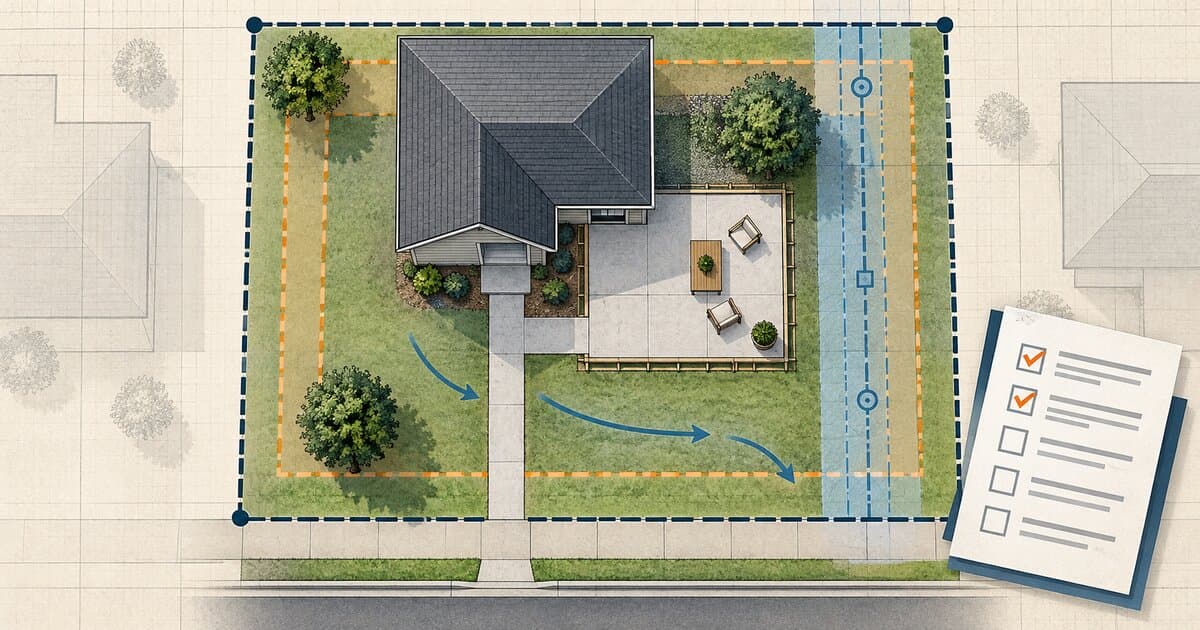
Calculate impervious surface coverage without relying on national defaults: identify the controlling rule, counted surfaces, site area, treatment path, and parcel evidence.

Impervious surface coverage is a zoning or stormwater calculation that compares surfaces a local rule treats as impervious with the land area that rule tells you to use. The basic arithmetic is simple:
Impervious coverage = counted impervious area ÷ ordinance-defined site area × 100
The hard part is not the division. It is identifying the controlling jurisdiction, the surfaces included in the numerator, the land included in the denominator, and any local treatment or mitigation provisions. There is no reliable national maximum and no universal list of counted surfaces. A roof, gravel drive, raised deck, or permeable patio can be treated differently from one ordinance to the next.
Use this guide to build a defensible screening calculation. Before relying on the result for design or construction, confirm the parcel boundary, the applicable ordinance, and the reviewing authority.
Start with four questions
An impervious-coverage answer is only as reliable as these four inputs:
- Which authority and rule apply? A city, county, watershed district, shoreland overlay, subdivision approval, or another agency may control. More than one review can apply to the same parcel.
- What goes in the numerator? Read the local definition and worksheet. Do not assume every hard surface counts—or that gravel, decks, overhangs, and walls do not.
- What goes in the denominator? Some rules use the whole lot; others exclude road right-of-way, wetlands, submerged land, or another defined area.
- Can treatment or mitigation change the result? A jurisdiction may recognize a designed treatment system or require mitigation above a threshold. That is an approval path, not permission to subtract an area on your own.
If any one of these inputs is unknown, treat the percentage as a planning estimate rather than a compliance conclusion.
How to calculate impervious surface coverage
Build the calculation from a scaled survey or site plan:
- Confirm the parcel and the land area the rule uses.
- Draw and label every existing surface addressed by the local definition.
- Add the proposed project as a separate layer.
- Measure each footprint using the method required by the reviewing authority.
- Remove overlaps so the same ground is not counted twice.
- Divide the final counted area by the ordinance-defined site area and multiply by 100.
- Compare the result with the correct threshold and review path.
A hypothetical arithmetic example
Suppose a local worksheet directs you to use 10,000 square feet as the calculation area. Existing counted surfaces total 2,100 square feet, and a proposed patio adds 300 square feet without overlapping another counted surface.
| Calculation component | Area |
|---|---|
| Existing counted surfaces | 2,100 sq. ft. |
| Proposed counted surface | 300 sq. ft. |
| Total counted area | 2,400 sq. ft. |
| Ordinance-defined site area | 10,000 sq. ft. |
The screening calculation is 2,400 ÷ 10,000 × 100 = 24%.
That 24% is only arithmetic. It does not establish that the site area is correct, that every surface was classified correctly, that 24% is allowed, or that the project is permit-exempt. Those are local legal and factual questions.
What may count as impervious surface?
Use the controlling definition, not a generic checklist. One useful official example is Waukesha County, Wisconsin's impervious-surface worksheet for certain shoreland lots. Its measurement categories include building footprints and overhangs, decks and patios, retaining walls, and driveways and sidewalks—including paved, concrete, gravel, or compacted surfaces.
| Surface to inventory | What to verify locally |
|---|---|
| Roofs and building footprints | Whether eaves or overhangs are included and how they are measured |
| Driveways and parking pads | Whether gravel, compacted stone, wheel strips, or only paved area counts |
| Walkways and patios | Whether material, joints, base construction, or drainage design changes classification |
| Decks | Whether the footprint counts and how a deck above another surface is handled |
| Pools and accessory features | Whether the water surface, coping, equipment pad, or surrounding deck is included |
| Retaining walls | Whether the wall footprint, a per-linear-foot convention, or disturbed area is used |
| Proposed additions, garages, sheds, and ADUs | Whether roof projection or foundation footprint supplies the measurement |
This table is an inventory aid—not a national definition. For example, Waukesha County's worksheet asks users to avoid double-counting decks or patios directly below another impervious surface and uses a specific convention for retaining walls. Another authority may use different categories or methods.
The denominator can change the answer
The site area in the denominator deserves the same care as the paved and roofed area in the numerator. Waukesha County's worksheet says its lot-size figure excludes established road right-of-way. Other ordinances may define their measurement area differently.
Do not copy parcel acreage from a geocoder or an unverified map and present it as survey-grade area. A parcel viewer can help identify a likely record, but tax mapping, legal boundaries, shoreland lines, rights-of-way, and field conditions can disagree. For a design decision, use the source the reviewing authority accepts—often a survey, recorded plat, or approved site plan.
Why shoreland rules need a separate check
Shoreland coverage is a good example of why a national percentage is unsafe. Wisconsin's Department of Natural Resources describes a state-and-local shoreland zoning partnership: county ordinances must meet or exceed statewide minimums, and counties may add requirements.
For unincorporated shoreland areas, the DNR describes the jurisdictional band as land within 1,000 feet of a lake, pond, or flowage, or within 300 feet of a river or stream or to the landward side of the floodplain, whichever distance is greater. The impervious-surface standard is narrower: it applies within 300 feet of the ordinary high-water mark. Within that area, the program guidance says properties may have up to 15% impervious surfaces; above 15% and up to 30% may be possible with shoreland mitigation. The county ordinance and parcel facts still control.
These percentages are a Wisconsin unincorporated-shoreland example within 300 feet of the ordinary high-water mark, not a national residential rule and not a substitute for checking whether a parcel is inside that measurement area. A city lot, a parcel in another state, or a county ordinance with stricter provisions can follow a different path.
Treated surfaces and mitigation are not automatic exclusions
Do not assume that a product labeled “permeable” or a surface connected to a rain garden can simply be omitted. The reviewing authority may require a designed system, calculations, maintenance obligations, and approval before recognizing treatment.
Waukesha County's treated-impervious-surface packet illustrates the point. The county may exclude an impervious surface from its calculation when the owner demonstrates that runoff from the first 0.5 inch of rainfall is treated by an approved best management practice or discharged to an internally drained pervious area that retains the runoff. The packet also describes a stormwater permit, technical standards, possible professional plan preparation, a financial guarantee, and a recorded deed restriction.
That is a documented local process. It does not mean every jurisdiction credits treatment, that the same rainfall amount applies elsewhere, or that installing permeable pavers by itself changes the coverage numerator.
Apply the calculation to the proposed project
Impervious coverage is usually one part of a larger permit and buildability decision.
Patio, walkway, or driveway
Separate the surface itself from related right-of-way, drainage, grading, easement, and utility questions. A patio that is building-permit-exempt can still be constrained by zoning or stormwater rules. Review the concrete patio and walkway permit guide before treating coverage as the only gate.
Garage or shed
Add the correct roof or footprint area, then test the structure's setbacks, height, use, utility conflicts, and permit path. The garage and shed feasibility guide explains why a small-structure exemption does not answer every site question.
Deck
Verify whether the local definition counts the deck footprint and how it treats the area below. Then check structure, footing, guard, stair, setback, and easement requirements in the deck permit guide.
Addition or ADU
Model existing and proposed conditions separately. Coverage can eliminate one layout while setbacks, access, utilities, parking, or building-code requirements eliminate another. For an accessory dwelling unit, use the parcel-first ADU feasibility guide.
A practical document checklist
Bring the reviewing authority a calculation it can audit:
- a current survey or accepted base plan;
- parcel boundaries and the locally defined calculation area;
- existing buildings, roof overhangs, driveways, walks, patios, decks, pools, walls, and other classified surfaces;
- proposed work shown separately from existing conditions;
- dimensions and an area schedule for every counted polygon;
- a note explaining how overlaps were removed;
- zoning, shoreland, watershed, floodplain, or subdivision overlays that may change the rule;
- drainage direction, treatment areas, and supporting calculations when a credit is requested; and
- the ordinance section, official worksheet, or staff direction used for the numerator and denominator.
If the site is close to a limit, ask what measurement precision and plan credentials are required. A rough online measurement may be useful for screening but inadequate for an application.
How GovCodex should be used
GovCodex can help identify the likely authority, organize the questions, and carry a supported result into the permit workflow. It should not invent a parcel area, infer an impervious threshold from a nearby jurisdiction, or turn an unreviewed map layer into a buildable-envelope conclusion.
Run Permit Check with your address and project scope. Where reviewed coverage exists, the result can surface the applicable permit path and the evidence behind it. Where coverage or parcel facts are incomplete, the correct result is to identify what must be verified—not to fill the gap with a national default.
Frequently Asked Questions
Is there a standard maximum impervious surface percentage?
No. The maximum, calculation area, surface definition, and approval path are set by the applicable local or state rule. A percentage published for one city, county, watershed, or shoreland program is not a national default.
Do gravel driveways count as impervious surface?
They can. Waukesha County's shoreland worksheet includes gravel and compacted driveways and sidewalks, but another jurisdiction may classify materials differently. Check the local definition and worksheet.
Does a deck count toward impervious coverage?
It may. Verify whether the rule counts the deck footprint and how it handles another impervious surface below the deck. Do not count the same ground twice unless the local method expressly requires it.
Are permeable pavers excluded?
Not automatically. Some authorities recognize approved treatment systems or internally drained areas only after technical review and continuing maintenance obligations. Product labeling alone does not establish a credit.
Is impervious coverage the same as building or lot coverage?
Not necessarily. Building coverage often focuses on structures, while impervious coverage can include roofs, paving, walks, patios, and other surfaces defined by the ordinance. Compare the actual definitions; a project may have to satisfy both limits.
Can I use the parcel area shown by an online map?
Use it only as an initial screen unless the reviewing authority accepts it. Road right-of-way, recorded boundaries, submerged land, or other exclusions can change the denominator. A survey or approved plan is safer for a close calculation.
Does a permit exemption mean coverage rules do not apply?
No. A project can be exempt from one building permit and still be subject to zoning, stormwater, shoreland, drainage, right-of-way, or other approvals.
What happens if existing coverage is already over the current limit?
The answer is jurisdiction-specific. Rules may distinguish maintenance, repair, reconstruction, expansion, relocation, treatment, mitigation, and legal nonconforming conditions. Confirm the authorized path before changing the surface.
Can mitigation let me build above a threshold?
Sometimes, under a rule that expressly allows it and after the reviewing authority accepts the required plan. Wisconsin's unincorporated-shoreland program is one example, but its percentages and mitigation path should not be applied elsewhere.
Who confirms the final calculation?
The agency administering the controlling zoning, shoreland, watershed, or stormwater rule confirms compliance. A surveyor, engineer, architect, or other qualified professional may need to prepare the plan when the authority or project requires it.
Related GovCodex guides
Sources
Last reviewed: September 10, 2026. Requirements vary by jurisdiction and property.
Related Articles
Do You Need a Permit to Pour Concrete? Patios, Slabs & Walkways
Pouring concrete may be permit-exempt or regulated depending on whether it is a patio, slab, walkway, driveway, structural base, or right-of-way work.

Best Permit Software for Homeowners Who Need Clear Answers
Compare homeowner permit software for decks, fences, garages, remodels, additions, ADUs, zoning checks, document prep, and official city portals.

Bloomington, MN Building Permit Guide (2025-2026)
How to get a building permit in Bloomington, Minnesota: which department issues permits, what's exempt, zoning setbacks, ADU rules, fees, contractor rules, and inspections.