
01 / SAMPLE SCREEN
Check the property and permit path
Start with an address and a proposed project. See available parcel and authority evidence, likely next steps, and the questions that still need local confirmation.
Try Permit CheckProperty intelligence for building permits and zoning
Start with a property and an idea. Check the permit path, explore what fits in Builder, and carry a reviewable plan to the people who will design, build, or approve it.
First check each month is free. Check availability: Wisconsin, Illinois and Minnesota
Building permit and zoning compliance review required. Next action: submit a site plan showing setbacks.
Sample output for an example parcel, shown to illustrate the workflow. It is not a determination for a real property.
The problem
One project can involve parcel records, zoning maps, municipal ordinances, county overlays, state building code, permit forms and several reviewing authorities. GovCodex resolves them around a single property and a single project.
One property. One project. Every applicable authority, rule, constraint and source resolved in one model.
How GovCodex works
Each layer depends on the one before it. Property resolves the parcel, the parcel resolves the jurisdiction, the jurisdiction resolves the code, and the code meets the geometry of what you actually want to build.
The address is resolved against county parcel records, not a generic geocode.
Inside GovCodex
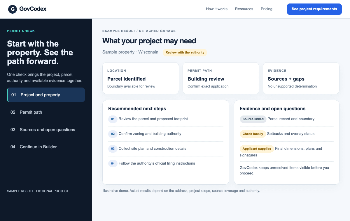
See how the work continues after a permit search. These sample screens illustrate the workflow; findings and available tools depend on the property and local coverage.
Start with an address and a proposed project. See available parcel and authority evidence, likely next steps, and the questions that still need local confirmation.
Try Permit Check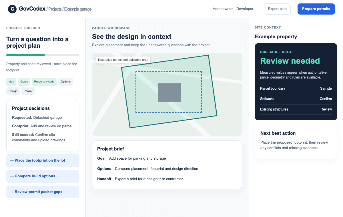
Carry the check into a saved workspace. Explore the lot, compare placement and design options, and make the missing inputs visible before preparation.
Start a project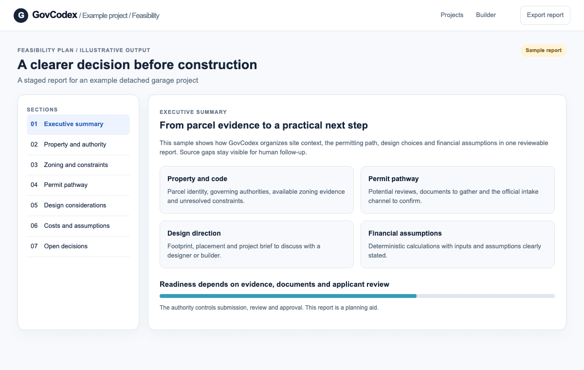
Bring property findings, permit steps, design direction, and assumptions into a feasibility report or project brief. Confirm official forms and filing instructions with the authority.
Explore feasibility planningIllustrative UI demos with fictional project data. GovCodex supports research and preparation; the issuing authority controls submission, review, and approval.
Worked example
Every panel below is sample output for one example parcel, shown to illustrate what a GovCodex answer contains. Run a check on your own address for findings tied to the current ordinance.
Can I build a 24 × 36 detached garage at 421 N 3rd Ave, Sturgeon Bay?
Yes, subject to placement. A detached garage of this size is allowed in the R-2 district as an accessory structure if it sits in the rear yard, holds the interior side setback and keeps total lot coverage under the district maximum.
Evidence
Findings carry the ordinance, the authority that enforces it and the date the record was last verified. Where a condition could change the answer, GovCodex says so instead of manufacturing certainty.
Read the methodology →Detached accessory structures must maintain a minimum 7 ft interior side setback in the R-2 district.
Sample finding. The figures and section reference above illustrate the shape of a GovCodex answer; run a check on your own address for findings tied to the current ordinance.
Understand how the rule affects this project on this property — with the parcel, the authority, the code and the permit path resolved together.
Check the property and likely permit path, test a project idea, then bring clear questions and a project brief to your designer, contractor, or local office.
For homeowners →Screen a site before bidding, compare build options with a client, and keep source links, assumptions, and packet gaps in one saved project.
For builders →Coverage
Every jurisdiction exposes its ordinances, parcel data and permit information differently. Coverage is stated per state and per jurisdiction rather than implied to be uniform.
Local pilots: North Carolina — Raleigh and unincorporated Wake County pilot
For builders and development teams with recurring project volume.
Talk to us →GovCodex is a property intelligence platform that connects a proposed construction or renovation project with parcel data, zoning requirements, permitting authorities and official government sources.
GovCodex identifies the zoning district, dimensional standards, overlays and permit triggers that apply to a specific parcel, then relates them to the project you describe. Final determinations rest with the authority having jurisdiction.
From primary sources: municipal zoning ordinances, county GIS and parcel records, state building codes, department pages, official permit forms and published environmental datasets. Each finding links to the record behind it.
No. GovCodex organizes and cites the rules your building department enforces. Permits are still issued, reviewed and inspected by the local authority.
Tell GovCodex what you want to build and see what applies before you spend time or money in the wrong direction.